Technology
The latest trends, gadgets, and breakthroughs shaping the future of technology.
Wine 11 Just Rewrote How Linux Runs Windows Games — And the Speed Gains Are Absurd
- Turker Senturk
- Gaming , Technology
- 6 min read
- 27 Mar, 2026
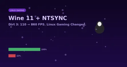
Here's a benchmark number that looks like a typo: Dirt 3 went from 110.6 FPS to 860.7 FPS on Linux. That's a 678% performance improvement. It's not a typo. It's what Wine 11's new NTSYNC support does
read more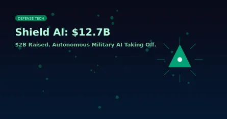
Shield AI Just Raised $2 Billion and Doubled Its Valuation in a Year
- Turker Senturk
- AI , Technology
- 5 min read
- 27 Mar, 2026
When a company's valuation more than doubles in a single year while the product is actively flying combat missions in a war zone, it tends to attract serious institutional money. That's exactly where
read more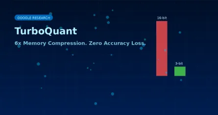
Google's TurboQuant Compresses AI Memory by 6x — With Zero Accuracy Loss
- Turker Senturk
- AI , Technology
- 6 min read
- 27 Mar, 2026
Every time you have a long conversation with an AI, your GPU is quietly sweating. It has to keep track of everything you've said — every token, every context — in something called the key-value (KV) c
read more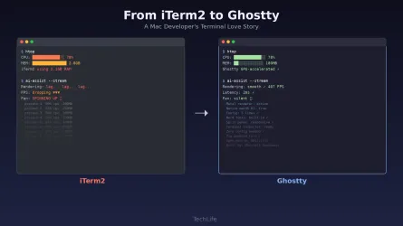
Why I finally traded iTerm2’s features for Ghostty’s GPU renderer
- Turker Senturk
- Software , Technology
- 15 min read
- 09 Mar, 2026
There's a moment every developer remembers. Not the first time they wrote "Hello World" — that's romanticized nonsense. I mean the first time you opened a real terminal, saw a blinking cursor staring
read more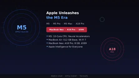
Apple Unleashes the M5 Era and Shocks Everyone With the $599 MacBook Neo
- Turker Senturk
- Hardware , Technology
- 14 min read
- 09 Mar, 2026
Apple just threw down the gauntlet. At its highly anticipated March 2026 event — held simultaneously in New York, London, and Shanghai — the company didn't just iterate. It redefined what we should ex
read more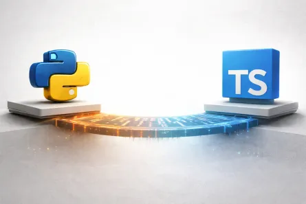
Vercel Just Proposed a TypeScript-Inspired Upgrade to Python's Type System
- Turker Senturk
- Software , Technology
- 10 min read
- 08 Mar, 2026
If you've ever jumped between a TypeScript codebase and a Python one, you know the feeling. TypeScript gives you this almost magic-like type system where you can slice, dice, and reshape types at comp
read more
Samsung is the #1 global TV brand for 20 years
- Türker Şentürk
- Technology
- 11 min read
- 08 Mar, 2026
Samsung’s 20‑Year TV Crown: Why the Brand Still Feels Like the Cool Kid at the Dinner Table Source: [Samsung Global Newsroom](https://news.samsung.com/global/samsung-electronics-marks-20-consecutive-
read more
5 Essential Tips for Choosing the Right VPS Hosting in 2026
- Turker Senturk
- Technology
- 8 min read
- 07 Mar, 2026
So you've outgrown shared hosting. Maybe your site's getting more traffic, or you're tired of sharing resources with a hundred other websites on the same box. Whatever the reason, you're looking at VP
read more
A Senior Engineer's Guide to Prompting AI for Real Code
- Turker Senturk
- Technology , Software
- 13 min read
- 07 Mar, 2026
If your idea of using AI for coding still involves tabbing twice to accept a generic boilerplate function, we need to talk. We're way past the era of mere code completion. As of early 2026, OpenAI Cod
read more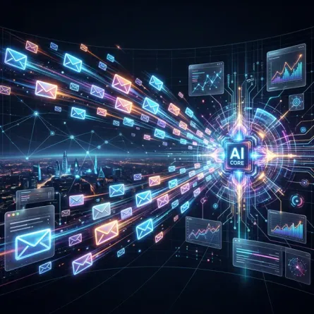
How to Scale Your Outreach: The Ultimate Guide to Cold Emails in 2026
- Turker Senturk
- Technology
- 5 min read
- 01 Mar, 2026
If your idea of scaling cold email in 2026 still involves loading an unverified dataset of 10,000 leads into a single platform, blindly hitting "send," and hoping for a 1% conversion rate, we urgently
read more
Real-time monitoring system tracks rapid fluctuations of qubits.
- Türker Şentürk
- Technology
- 11 min read
- 20 Feb, 2026
Real‑Time Qubit Watchdogs: How a Copenhagen Team Turned a Millisecond Mystery into a Quantum Advantage When I first walked into the Niels Bohr Institute (NBI) for a “quick chat” with a postdoc, I expe
read more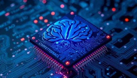
Brain-Inspired Computers Excel at Math
- Türker Şentürk
- Technology
- 11 min read
- 14 Feb, 2026
Brain‑Inspired Chips Are Solving Supercomputer Math—And They’re Doing It on a Latte‑Budget Power Bill When I first saw a neuromorphic chip on a lab bench, it looked a bit like a futuristic LEGO brick—
read more
Robot Learns Realistic Lip Movements by Observation
- Türker Şentürk
- Technology
- 10 min read
- 17 Jan, 2026
The Robot That Learned to Talk Like a Human (and Finally Stopped Looking Creepy) When you watch a video of a humanoid robot trying to say “hello,” you’ve probably seen the same old nightmare: a stiff,
read more
Samsung Wallet Meets Toyota: Your Phone as a Car Key
- Turker Senturk
- Technology
- 10 min read
- 13 Jan, 2026
Samsung Wallet Meets Toyota: Your Phone as a Car Key If you’ve ever fumbled for a house key while juggling groceries, you’ll understand the tiny thrill that comes from a phone‑only unlock. Now Samsung
read more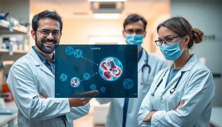
This AI Can Spot Dangerous Blood Cells That Doctors Often Miss
- Turker Senturk
- Technology
- 10 min read
- 13 Jan, 2026
Picture this: You're a doctor at the end of a grueling 12-hour shift. Your eyes are tired, your coffee has gone cold for the third time, and there's still a stack of blood smears waiting to be analyze
read more
Microscopic Autonomous Robots Smaller Than a Grain of Salt
- Turker Senturk
- Technology
- 3 min read
- 06 Jan, 2026
Have you ever looked at a single grain of salt and thought, "I bet I could fit a whole computer in there"? Probably not. But scientists at the University of Pennsylvania just did exactly that—and then
read more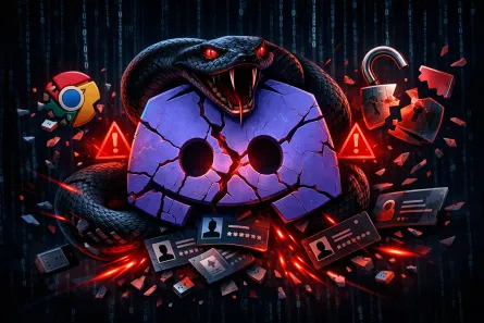
VVS Stealer: How This Python-Based Malware Targets Discord Users Through Advanced Obfuscation
- Turker Senturk
- Security , Technology
- 10 min read
- 06 Jan, 2026
If you're a Discord user, you might want to pay attention to this one. Security researchers have recently uncovered a nasty piece of malware called VVS Stealer (sometimes written as VVS $tealer) that'
read more
ACM Opens the Gates: Over 600,000 Computer Science Papers Now Free to Everyone
- Turker Senturk
- Technology
- 7 min read
- 05 Jan, 2026
Something historic happened on January 1, 2026. The Association for Computing Machinery (ACM), the world's largest organization of computing professionals, flipped the switch on one of the most signif
read more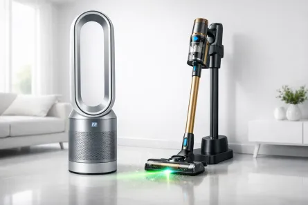
Dyson 2025: Sensor-Driven Vacuums, Smarter Purifiers, and a New Recycling Initiative
- Turker Senturk
- Technology
- 10 min read
- 05 Jan, 2026
Dyson has been busy throughout 2025, rolling out significant updates to its flagship product lines. The British technology company, known for its premium approach to home appliances, has introduced th
read more
Tiny Chip That Could Transform Quantum Computing
- Turker Senturk
- Technology
- 3 min read
- 26 Dec, 2025
Key HighlightsThe Big Picture: A chip thinner than a human hair can precisely steer laser light for future quantum computers. Technical Edge: Uses 80 × less microwave power than conventional modulat
read more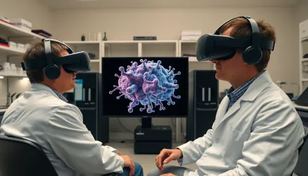
NVIDIA RTX GPUs Power VR Memory Research at MBL
- Turker Senturk
- Technology
- 3 min read
- 23 Dec, 2025
Key HighlightsThe Big Picture: Researchers blend AI, VR, and high‑performance hardware to map memory proteins in the hippocampus. Technical Edge: NVIDIA RTX GPUs and HP Z Workstations enable 10 TB o
read more
Samsung Unveils AI‑Vision Kitchen Lineup at CES 2026
- Turker Senturk
- Technology
- 3 min read
- 22 Dec, 2025
Key HighlightsThe Big Picture: Samsung rolls out a new Bespoke AI kitchen family at CES 2026, all powered by vision AI built on Google Gemini. Technical Edge: The AI Vision now auto‑registers proces
read more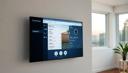
SmartThings Matter Camera Support: Samsung Leads the Way
- Turker Senturk
- Technology
- 2 min read
- 21 Dec, 2025
Key HighlightsThe Big Picture: Samsung SmartThings is the first smart‑home hub to support Matter 1.5 cameras. Technical Edge: Native Matter camera support adds live streaming, two‑way talk, and PTZ
read more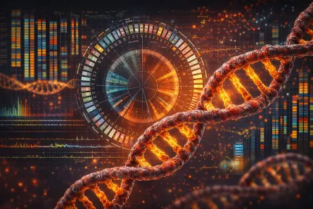
RNACOREX Opens the Black Box of Cancer Gene Networks
- Turker Senturk
- Technology
- 2 min read
- 21 Dec, 2025
Key HighlightsThe Big Picture: RNACOREX reveals hidden miRNA‑mRNA regulatory maps across dozens of tumor types. Technical Edge: AI‑level survival prediction with transparent, interpretable explanati
read more
NVIDIA RTX PRO 5000 72GB Blackwell GPU Now Available
- Turker Senturk
- Technology , Hardware
- 3 min read
- 18 Dec, 2025
Key HighlightsEnhanced AI Performance: The NVIDIA RTX PRO 5000 72GB Blackwell GPU offers 2,142 TOPS of AI performance, a significant boost for AI development. Increased Memory: 72GB of ultrafast GDDR7
read more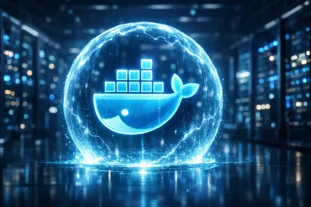
Docker Hardened Images: Making Container Security Free and Accessible for Everyone
- Turker Senturk
- Technology , Security
- 5 min read
- 18 Dec, 2025
Introduction Docker has just announced a watershed moment for the container ecosystem: Docker Hardened Images (DHI) are now free and open-source for everyone. This groundbreaking move transforms how d
read more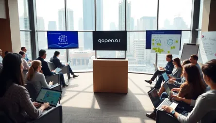
OpenAI Launches Academy for News Organizations
- Turker Senturk
- Technology
- 3 min read
- 18 Dec, 2025
Key HighlightsEmpowering Journalism: OpenAI Academy for News Organizations is launched to support journalists and publishers in leveraging AI. Practical Training: The academy offers on-demand training
read more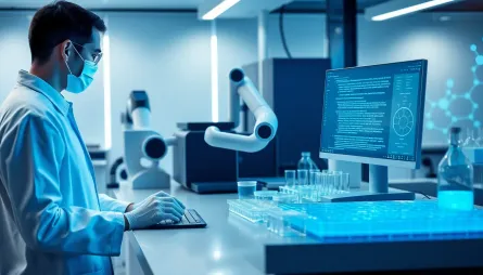
AI Accelerates Biological Research: A Breakthrough in Wet Lab Efficiency
- Turker Senturk
- Technology
- 3 min read
- 17 Dec, 2025
Key HighlightsCore Insight: AI-powered optimization of wet lab protocols has led to a 79x increase in efficiency, marking a significant breakthrough in biological research. Detail: The AI model, GPT-5
read more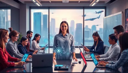
AI Literacy Revolutionizes Workplace Operations
- Turker Senturk
- Technology
- 3 min read
- 17 Dec, 2025
Key HighlightsAI Literacy Matters: 42% of US employees expect AI to significantly change their role over the next year. Upskilling Demand: 32% of workers feel increased pressure to learn new skills be
read more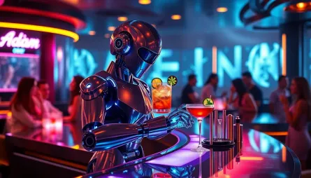
Robot Bartender Serves Up a Taste of the Future
- Turker Senturk
- Technology
- 3 min read
- 13 Dec, 2025
Key HighlightsInnovative Solution: ADAM, a robot developed with NVIDIA Isaac libraries, is pouring drinks and turning heads at the T-Mobile Arena in Las Vegas. Real-World Impact: ADAM addresses labor
read more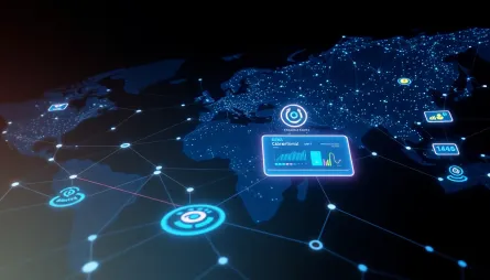
BBVA and OpenAI Revolutionize Global Banking with AI
- Turker Senturk
- Technology
- 2 min read
- 13 Dec, 2025
Key HighlightsAI-Powered Banking: BBVA and OpenAI are expanding their collaboration to bring ChatGPT Enterprise to 120,000 employees worldwide. Transforming Customer Experience: The partnership aims t
read more
Disney and OpenAI Partner to Revolutionize Storytelling
- Turker Senturk
- Technology
- 3 min read
- 11 Dec, 2025
Key HighlightsGroundbreaking Partnership: The Walt Disney Company and OpenAI have reached a landmark agreement to bring Disney's iconic characters to OpenAI's Sora platform. Innovative Storytelling: T
read more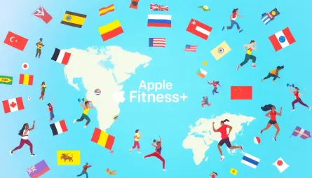
Apple Fitness+ Expands to 28 New Markets, Adds New Features
- Turker Senturk
- Technology
- 2 min read
- 09 Dec, 2025
Key HighlightsApple Fitness+ is expanding to 28 new markets, including Chile, Hong Kong, India, and Japan The service now offers digitally dubbed versions of workouts and meditations in Spanish, Germa
read more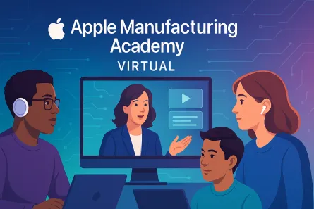
Apple Expands Manufacturing Academy with Virtual Programming
- Turker Senturk
- Technology
- 3 min read
- 09 Dec, 2025
Key HighlightsApple expands its Manufacturing Academy with virtual programming to support small- and medium-sized businesses The program offers free training in advanced manufacturing technologies, in
read more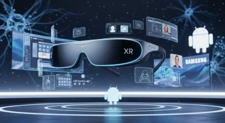
Galaxy XR Revolutionizes Android Ecosystem
- Turker Senturk
- Technology
- 3 min read
- 09 Dec, 2025
Key HighlightsGalaxy XR debuts with Android XR platform, co-developed with Google and Qualcomm New features include PC Connect, Likeness, and Travel Mode, enhancing user experience Galaxy XR set to ro
read more
Samsung Galaxy S25 FE Elevates Night Run Storytelling
- Turker Senturk
- Technology
- 3 min read
- 05 Dec, 2025
Key HighlightsSamsung's Galaxy S25 FE enables users to capture high-quality content in low-light conditions with Nightography The device's Galaxy AI features allow for advanced editing and sharing cap
read more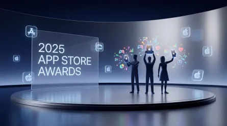
Apple Unveils 2025 App Store Awards Winners
- Turker Senturk
- Technology
- 2 min read
- 05 Dec, 2025
Key HighlightsApple announces the winners of the 2025 App Store Awards, recognizing 17 apps and games The winners were selected for their technical ingenuity and lasting cultural impact Tim Cook, Appl
read more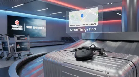
Samsung Elevates Travel with SmartThings Find
- Turker Senturk
- Technology
- 3 min read
- 01 Dec, 2025
Key HighlightsSamsung partners with Turkish Airlines to launch Smart Tagged Baggage Service SmartThings Find enables passengers to track lost or delayed baggage using Galaxy SmartTag2 The service aims
read more
Samsung Unveils R20 Ultrasound System
- Turker Senturk
- Technology
- 2 min read
- 01 Dec, 2025
Key HighlightsThe Samsung R20 Ultrasound System is set to be unveiled at the RSNA 2025 Annual Meeting The system features Advanced Imaging Engine and AI-powered tools for enhanced diagnostic precision
read more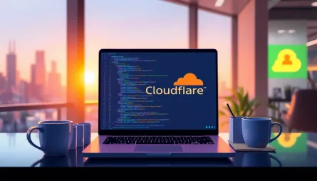
Cloudflare Unveils Remote Bindings for Local Development
- Turker Senturk
- Technology
- 2 min read
- 01 Dec, 2025
Key HighlightsCloudflare introduces remote bindings for local development, allowing developers to test code against real production data This feature supports R2 buckets and D1 databases, enabling fas
read more
AWS X-Ray Shifts to OpenTelemetry
- Turker Senturk
- Technology
- 3 min read
- 29 Nov, 2025
Key HighlightsAWS announces the transition of AWS X-Ray to OpenTelemetry for application tracing and observability The AWS X-Ray SDKs and Daemon will enter maintenance mode on February 25, 2026 OpenTe
read more
Samsung Unveils Eco-Friendly T7 Resurrected Portable SSD
- Turker Senturk
- Technology
- 2 min read
- 29 Nov, 2025
Key HighlightsThe T7 Resurrected Portable SSD features a 100% recycled aluminum body, reducing electronic waste The device delivers high-speed storage with sequential read speeds of up to 1,050 MB/s a
read more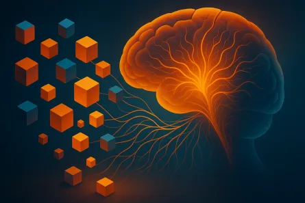
Unlocking the Brain's Hidden Learning Blocks
- Turker Senturk
- Technology
- 3 min read
- 28 Nov, 2025
Key HighlightsThe brain uses cognitive Legos to reuse and recombine existing knowledge, enabling quick adaptation to new tasks. This discovery could lead to the development of more human-like AI syste
read more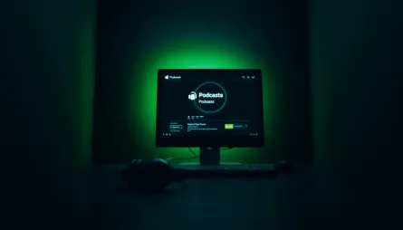
Apple Podcasts Security Concerns
- Turker Senturk
- Technology
- 2 min read
- 28 Nov, 2025
Key HighlightsMysterious podcasts are appearing in Apple Podcasts, potentially due to a security vulnerability Some podcasts contain links to malicious websites, including XSS attacks Apple has not re
read more
OpenAI's Approach to Mental Health Litigation
- Turker Senturk
- Technology
- 3 min read
- 26 Nov, 2025
Key HighlightsOpenAI prioritizes handling mental health-related court cases with care and transparency The company recognizes the complexity and nuances of situations involving real people and real li
read more
Microsoft Copilot Fall Release: AI-Powered Productivity
- Turker Senturk
- Technology
- 3 min read
- 25 Nov, 2025
Key HighlightsMicrosoft's Copilot Fall Release brings twelve new features for enhanced productivity and collaboration Mico, a new virtual assistant character, is introduced as the animated face of Cop
read more
Hugo Static Site on Cloudflare: Why I chose Cloudflare Pages and How I Did It in 10 Minutes
- Türker Şentürk
- Technology
- 3 min read
- 24 Nov, 2025
A Hugo Solution for a New Blog? But How? You want to write a blog. You have your articles. Or you have the desire to write but haven't decided what to use yet. There are dozens of solutions made for t
read more
Smart Cities Revolutionized with AI and Digital Twins
- Turker Senturk
- Technology
- 2 min read
- 21 Nov, 2025
Key HighlightsCities worldwide are adopting digital twins and AI to enhance operational efficiency The NVIDIA Blueprint for smart city AI enables cities to simulate, train, and deploy AI agents OpenUS
read more
Galaxy Watch Saves Lives with Advanced Health Features
- Turker Senturk
- Technology
- 2 min read
- 20 Nov, 2025
Key HighlightsGalaxy Watch's Irregular Heart Rhythm Notification feature detects hidden heart conditions The ECG feature helps identify potential heart risks, such as blocked coronary arteries Blood O
read more
Spotify Acquires Music Database WhoSampled
- Turker Senturk
- Technology
- 3 min read
- 19 Nov, 2025
Key HighlightsSpotify acquires WhoSampled, a community-run database tracking sampled music The acquisition expands Spotify's music offerings and enhances user experience WhoSampled's database of over
read more