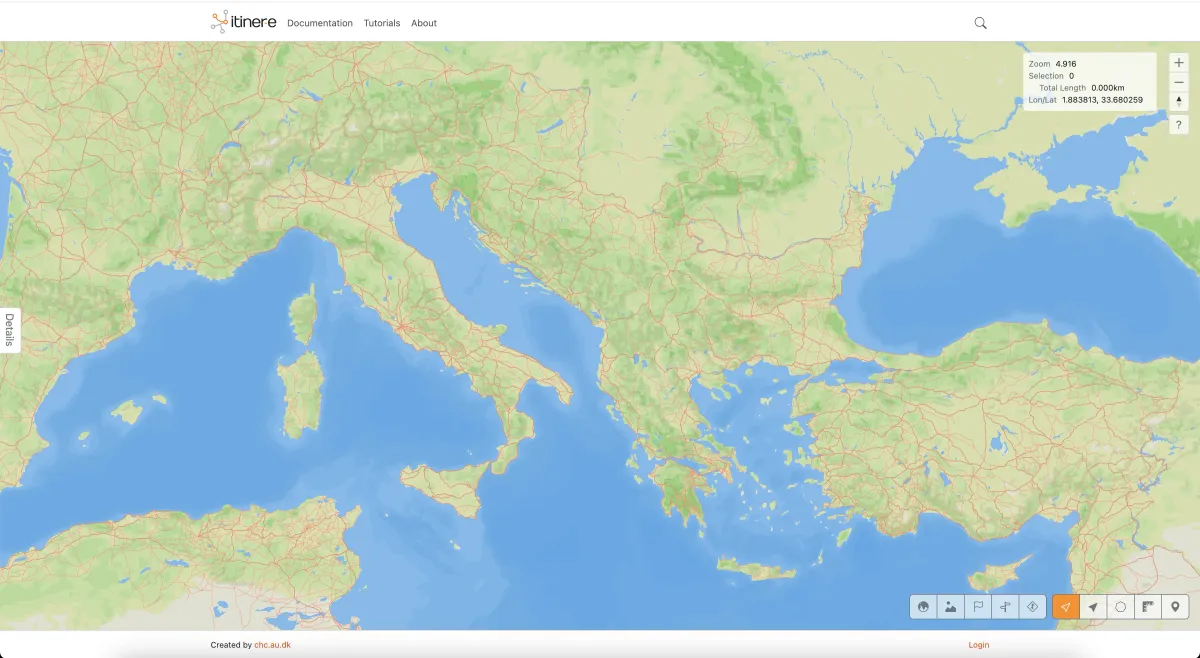
Roman Roads Mapped with Unprecedented Accuracy
- Turker Senturk
- Technology
- 10 Nov, 2025
- 3 min read
Key Highlights
- Researchers have created a high-resolution digital map of the Roman Empire’s road network, revealing nearly 300,000 kilometers of roads
- The map, called Itiner-e, allows users to plan routes along ancient roads and has the potential to “revolutionize our understanding of how people, ideas and infectious diseases” spread 2,000 years ago
- The project combines historical records with modern mapping techniques, providing a more accurate representation of the Roman road network than previous attempts
The creation of Itiner-e, a digital map of the Roman Empire’s road network, marks a significant milestone in the field of archaeology. By combining historical records with modern mapping techniques, researchers have been able to map hundreds of thousands of kilometers of roads with unprecedented accuracy. This move reflects broader industry trends towards the use of technology to enhance our understanding of historical events and cultural heritage.
Mapping the Roman Empire
The researchers behind Itiner-e began by identifying Roman roads from previous studies, including atlases, surveys, historical sources, and archaeological sources. They then compared this information to modern and historical aerial photographs, topographical maps, and satellite imagery. By digitizing each road section with a high spatial resolution, the team was able to create a highly accurate map of the Roman road network. The map includes nearly 300,000 kilometers of roads, with 200,000 kilometers of secondary roads mapped using higher spatial analysis.
The creation of Itiner-e has significant implications for our understanding of the Roman Empire and its impact on the spread of people, ideas, and diseases. As Tom Brughmans, a co-author of the study, notes, “It’s a growing resource for a community to keep on adding information to ensure that this remains the best representation of our knowledge of where all the roads in the Roman Empire were.” The map also reveals that the locations of only 3% of Roman roads are known with certainty, highlighting the need for further research and exploration.
Key Features of Itiner-e
- High-resolution mapping: The map provides a highly accurate representation of the Roman road network, with hundreds of thousands of kilometers of roads mapped
- Combination of historical and modern techniques: The researchers used a combination of historical records and modern mapping techniques to create the map
- Potential for further research: The map highlights the need for further research and exploration, with only 3% of Roman roads known with certainty
Conclusion
The creation of Itiner-e marks an important step forward in our understanding of the Roman Empire and its road network. By providing a highly accurate map of the Roman roads, researchers can gain new insights into the spread of people, ideas, and diseases 2,000 years ago. As Brughmans notes, “Such insights can be used to better understand the challenges we face today.” The map is a significant resource for historians, archaeologists, and researchers, and has the potential to “revolutionize our understanding” of the Roman Empire.
Source: Official Link
Tags :
Share :
Stay Ahead in Tech
Join thousands of developers and tech enthusiasts. Get our top stories delivered safely to your inbox every week.
No spam. Unsubscribe at any time.